mercator puzzle game
links and materials
from or related to Coursera geospatial revolution mooc 2013
Maps and the Geospatial Revolution
held by by Dr. Anthony C. Robinson
... part of what the geospatial revolution means is the advent of geospatial technology. Geospatial technology helps us create content that can be changed
Geospatial Revolution MOOC
https://class.coursera.org/maps-001/class/index
|
These are the slides to accompany the lectures of Maps and the Geospatial Revolution on Coursera by Anthony Robinson www.coursera.org/course/maps/
presentation transcript lesson 3, lecture 2
http://www.slideshare.net/AnthonyRobinson3/presentations
course linkshttps://class.coursera.org/maps-001/wiki/view?page=GettingStarted
https://class.coursera.org/maps-001/forum/thread?thread_id=1631 https://twitter.com/search?q=%23mapmooc&src=hash https://class.coursera.org/maps-001/forum/list https://class.coursera.org/maps-001/wiki/view?page=syllabus%20 Wiki - Mapping Assignment | Maps and the Geospatial Revolution http://www.slideshare.net/AnthonyRobinson3/presentations feeds from blogs |
web mapping glossary and learning bits...
graduated circles map
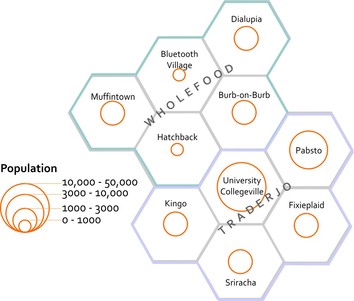
map using graduated circles (each circle size represents a given range, so the smallest circle size here would include everything from 0-1000)
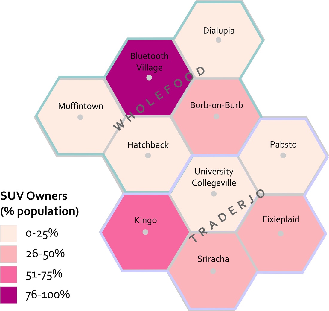
Photo Credit: Anthony C. Robinson choropleth map
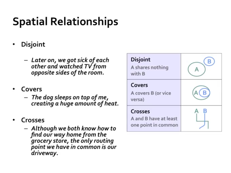
spatial relationships

scalestimegeospatial linkshttp://geospatialrevolution.psu.edu/
https://gis.e-education.psu.edu/ http://www.geography.wisc.edu/maplib/robinson_projection.html http://transpographics.blogspot.com/2012/05/theres-projection-that-looks-like.html http://www.esri.com/ Esri’s (www.esri.com) cloud-based GIS called ArcGIS Online. ArcGIS Online does many of the things a desktop GIS system can do, but it has a much easier learning curve, can be used right in your web browser, and makes it really easy to share interactive maps you make with others. http://blogs.esri.com/esri/arcgis/category/arcgis-online/ blog ArcGIS http://live.osgeo.org/ free and open-source software for doing all things geospatial http://www.citypopulation.de/ http://en.wikipedia.org/wiki/Global_Positioning_System Hurricane Sandy: The AfterMap Drag the line to explore storm damage through before and after imagery. more geospatial slideshare clipsfabriziobartoli saved slideshares |
