mapping
links to resources, blogs and tutorialsGoogle Faces
"Google Faces - searching for faces on Google Maps using face recognition" more from vimeo.com vimeo face recognition google maps google earth video tutorial mapping GoogleFaces for generative design. Google Faces searching for faces on Google Maps, The way we perceive our environment is a complex procedure. By the help of our vision we are able to recognize friends within a huge crowd, approximate the speed of an oncoming car or simply admire a painting. One of human's most characteristic features is our desire to detect patterns. We use this ability to penetrate into the detailed secrets of nature. However we also tend to use this ability to enrich our imagination. Hence we recognize meaningful shapes in clouds or detect a great bear upon astrological observations. Objective investigations and subjective imagination collide to one inseparable process. The tendency to detect meaning in vague visual stimuli is a psychological phenomenon called Pareidolia, and captures the core interest of this project. video tutorial: http://vimeo.com/66055499# more from www.onformative.com generative design mapping google earth maps google earth google maps art Drawing web2.0 Creative Uses of Google Earth and Google Maps | Technology on GOOD Google Maps and Google Earth are pretty awesome on their own—you can see the whole world on your laptop in the comfort of your living room. But what's even more awesome is the myriad way artists and developers are using these tools to create games, videos and photo series that are a delight to the eye. Here are a few to check out. more from www.good.is google earth maps google earth google maps mapping art GoogleTreks Google Maps Maps Engine Lite more from mapsengine.google.com googlemaps mapping google fabriziobartoliblogroll #mapping_tools my feeds
|
related pages:
| ||
news feeds from blogs and groups |
links, links, links tagged mapping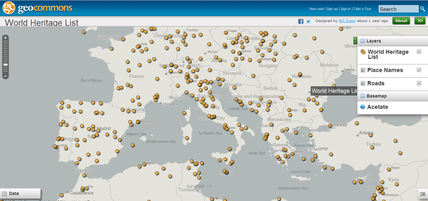
http://tigerweb.geo.census.gov/datamapper/map.html cosmology space images pinterest board http://pinterest.com/teobesta/cosmology/ "cosmology" space images pinterest board http://pinterest.com/amyadia/space/ NACIS: Welcome to NACIS.org | HOME http://www.nacis.org stamen design | big ideas worth pursuing http://www.stamen.com/ "Since 2001, Stamen has developed a reputation for beautiful and technologically sophisticated projects in a diverse range of commercial and cultural settings. We work and play with a surprising and growing range of collaborators: news media, financial institutions, artists and architects, car manufacturers, design agencies, museums, technology firms, political action committees, and universities." CartoTalk http://www.cartotalk.com Natural Earth http://www.naturalearthdata.com "Natural Earth is a public domain map dataset available at 1:10m, 1:50m, and 1:110 million scales. Featuring tightly integrated vector and raster data, with Natural Earth you can make a variety of visually pleasing, well-crafted maps with cartography or GIS software." Geospatial Metadata — Federal Geographic Data Committee http://www.fgdc.gov/metadata/ "Geospatial Metadata What are Metadata? A metadata record is a file of information, usually presented as an XML document, which captures the basic characteristics of a data or information resource. It represents the who, what, when, where, why and how of the resource. Geospatial metadata commonly document geographic digital data such as Geographic Information System (GIS) files, geospatial databases, and earth imagery but can also be used to document geospatial resources including data catalogs, mapping applications, data models and related websites. Metadata records include core library catalog elements such as Title, Abstract, and Publication Data; geographic elements such as Geographic Extent and Projection Information; and database elements such as Attribute Label Definitions and Attribute Domain Values." Wikimapia - Descriviamo il mondo intero! http://wikimapia.org/#lang=it&lat=38.116700&lon=13.366700&z=10&m=b GeoNames http://www.geonames.org/ "GeoNames The GeoNames geographical database covers all countries and contains over eight million placenames that are available for download free of charge." Introduction | EMS Open Educational Resources http://open.ems.psu.edu "The College's open educational resources are freely available for non-commercial use under a Creative Commons license." Lesson 1: Lidar Sensors | GEOG 497D: LIDAR Technology and Applications https://www.e-education.psu.edu/lidar/l1.html "Lesson 1: Lidar Sensors" GeoCommons https://www.diigo.com/item/image/1aq7b/ec6p GeoCommons http://geocommons.com "GeoIQ's enterprise analytics, enhanced visualization and data support features are now available for free to all GeoCommons users. Easily find answers to complex questions and share them with the world." Social Explorer http://www.socialexplorer.com/ "Visually Explore Demographic Data 220 years of demographic data, 18,000 maps, hundreds of profile reports, 40 billion data elements and 335,000 variables" Let’s Make a Map http://bost.ocks.org/mike/map/ "Let’s Make a Map In this tutorial, I’ll cover how to make a modest map from scratch using D3 and TopoJSON. I’ll show you a few places where you can find free geographic data online, and how to convert it into a format that is both efficient and convenient for display. I won’t cover thematic mapping, but the map we’ll make includes labels for populated places and you can extend this technique to geographic visualizations such as graduated symbol maps and choropleths." Guerrilla Cartography - Food: An Atlas http://www.guerrillacartography.net/home.htm "Food: An Atlas is a collection of maps,co-created by the guerilla cartographer community, a loose band of people who are passionate about food and geography." Architecture Museum - Canon CREATIVE PARK http://cp.c-ij.com/en/3D-papercraft/architecture/index2.html?log=m01 Xmen First Class movie Characters - Visualizations - DataWeave http://www.dataweave.in/visualizations/usage/3/Xmen-First-Class-movie-Characters "Xmen First Class movie Characters Most Discussed Xmen Characters on twitter for the movie Xmen: First Class" DataWeave - Home http://www.dataweave.in "DataWeave provides actionable data by aggregating, parsing, organizing and visualizing millions of data points from the Web. We help you discover, monitors, and analyze huge amounts of data. Much like the roots of a tree, DataWeave draws data from the web and makes it available for use in your Apps, Analytics and day to day decision making.DataWeave makes data access easy through APIs, dashboards, alerts, and visualizations." Steel Panthers Game - Download and Play Free Version! http://www.download-free-games.com/freeware_games/steel_panthers.htm Get Creative And Make Your Own Maps With Custom Layers On The New Google Maps http://www.makeuseof.com/tag/get-creative-and-make-your-own-maps-with-custom-layers-on-the-new-google-maps/#twitter Introducing MapBox Satellite | MapBox http://www.mapbox.com/blog/mapbox-satellite/ Introducing MapBox Satellite December 04 2012 By Eric Gundersen We just launched MapBox Satellite, our beautiful global imagery layer. We've been working hard to bring MapBox users a fast, beautiful satellite and aerial imagery layer that integrates seamlessly with MapBox Streets and custom overlays. We're happy to announce that it's available today and included in MapBox Basic plans and above. MapBox | Fast and beautiful maps http://www.mapbox.com "Design custom maps Easily add fast beautiful maps to your sites and apps. We help people spot local bars on foursquare, choose hotels on Hipmunk, and organize their lives with Evernote. Maps are the context and canvas for everything mobile and social, and we are the platform for making them tailored to fit your product." Geospatial topology - Wikipedia, the free encyclopedia http://en.wikipedia.org/wiki/Geospatial_topology "Geospatial topology studies the rules concerning the relationships between the points, lines, and polygons that represent the features of a geographic region. For example, where two polygons represent adjacent counties, typical topological rules would require that the counties share a common boundary with no gaps and no overlaps. Similarly, it would be nonsense to allow two polygons representing lakes to overlap" Geocoding Service - Google Maps JavaScript API v3 — Google Developers https://developers.google.com/maps/documentation/javascript/geocoding "Geocoding is the process of converting addresses (like "1600 Amphitheatre Parkway, Mountain View, CA") into geographic coordinates (like latitude 37.423021 and longitude -122.083739), which you can use to place markers or position the map. Reverse geocoding is the process of converting geographic coordinates into a human-readable address." Geocoding - Wikipedia, the free encyclopedia http://en.wikipedia.org/wiki/Geocoding "Geocoding is the process of finding associated geographic coordinates (often expressed as latitude and longitude) from other geographic data, such as street addresses, or ZIP codes (postal codes). With geographic coordinates the features can be mapped and entered into Geographic Information Systems, or the coordinates can be embedded into media such as digital photographs via geotagging. Reverse geocoding is the opposite: finding an associated textual location such as a street address, from geographic coordinates. A geocoder is a piece of software or a (web) service that helps in this process." Map Projections http://www.colorado.edu/geography/gcraft/notes/mapproj/mapproj_f.html Bing Mappe - Indicazioni stradali con condizioni stradali e del traffico http://it.bing.com/maps/?v=2&cp=47.793119~13.027240&lvl=12&dir=0&sty=h&q=salzburg&form=LMLTCC#Y3A9NDcuNzkzMTE5fjEzLjAyNzI0MCZsdmw9MTImc3R5PWgmcT1zYWx6YnVyZw== Choropleth map | Define Choropleth map at Dictionary.com http://dictionary.reference.com/browse/choropleth+map Editor delle mappe, produttore, OSM http://www.mapquest.it Salvare e condividere le mappe conLe Mie Mappe 29. Geometric Properties Preserved and Distorted | The Nature of Geographic Information https://www.e-education.psu.edu/natureofgeoinfo/c2_p29.html Geometric Properties Preserved and Distorted Printer-friendly versionPrinter-friendly version Many types of map projections have been devised to suit particular purposes. No projection allows us to flatten the globe without distorting it, however. Distortion ellipses help us to visualize what type of distortion a map projection has caused, how much distortion occurred, and where it occurred. The ellipses show how imaginary circles on the globe are deformed as a result of a particular projection. If no distortion had occurred in the process of projecting the map shown below, all of the ellipses would be the same size, and circular in shape. When positions on the graticule are transformed to positions on a projected grid, four types of distortion can occur: distortion of sizes, angles, distances, and directions. Map projections that avoid one or more of these types of distortion are said to preserve certain properties of the globe. QGIS - vittorio.casella http://vittoriocasella.unipv.it/qgis "In questa pagina si trovano le dispense di un corso tenutosi all'inizio del 2012" QGIS Application - Download - QGIS Issue Tracking http://hub.qgis.org/projects/quantum-gis/wiki/Download "QGIS is available on Windows, MacOS X, Linux and Android. Binary packages are provided for the current version. The current version is QGIS 1.8.0 and was released in June 2012. Quantum GIS is open source software available under the terms of the GNU General Public License meaning that its source code can be downloaded through tarballs or the git repository. For testing and learning purpose, we also provide a sample dataset, which contains collections of data from different sources and in different formats, like GPS data, a small GRASS location, GeoTiff, ERDAS Img, Shape or GML formats." Welcome to the Quantum GIS Project http://www.qgis.org Benvenuto nel progetto Quantum GIS Quantum GIS (QGIS) è un software GIS di facile utilizzo rilasciato sotto licenza GNU General Public License. QGIS è un progetto ufficiale della Open Source Geospatial Foundation (OSGeo). Funziona su Linux, Unix, Mac OSX, Windows e Android e supporta numerosi formati vettoriali, raster, e svariati database. L'ultima release è QGIS 1.8.0; http://www.dirap.unipa.it/~lobrutto/Pubblicazioni/Sifet2007- Dardanelli_Franco_LoBrutto.pdf http://www.dirap.unipa.it/~lobrutto/Pubblicazioni/Sifet2007-Dardanelli_Franco_LoBrutto.pdf INGV - Sezione di Catania http://www.ct.ingv.it/it/component/content/article/24-uf-deformazione-e-geodesia/uf-defo/171-la-rete-di-posizionamento-gnss-sicilinet-ingv-ct.html "LA RETE DI POSIZIONAMENTO GNSS SICILI@NET INGV CT" INGV CATANIA http://www.ct.ingv.it/it/ Welcome to the USGS - U.S. Geological Survey http://www.usgs.gov "StartwithScience Learn more about the future of our science. Climate and Land Use Change Core Science Systems Ecosystems Energy and Minerals Environmental Health Natural Hazards Water" Google Earth http://www.google.it/intl/it/earth/learn/ Visualization: Geochart - Google Charts — Google Developers https://developers.google.com/chart/interactive/docs/gallery/geochart"A Geochart is a map of a country, a continent, or a region with two modes: The region mode colorizes whole regions, such as countries, provinces, or states. The marker mode marks designated regions using bubbles that are scaled according to a value that you specify." INGV - Sezione di Catania http://www.ct.ingv.it/it/component/content/article/2-uncategorised/326-1981-leruzione-che-sfioro-la-citta-di-randazzo.html "MARZO 1981 - L'ERUZIONE CHE SFIORÒ LA CITTÀ DI RANDAZZO" Rischio vulcanico - Protezionecivile.it http://www.protezionecivile.gov.it/minisite/index.php?dir_pk=250&cms_pk=1439&n_page=2 Public Information Map http://tmappsevents.esri.com/Website/wildfire/ Usa wildfires map http://tmappsevents.esri.com/website/swipe_sandy/ http://tmappsevents.esri.com/website/swipe_sandy/ "Hurricane Sandy: The AfterMap" Welcome to OSGeo-Live 6.5 — OSGeo-Live 6.5 Documentation http://live.osgeo.org/en/index.html "OSGeo-Live is a self-contained bootable DVD, USB thumb drive or Virtual Machine based on Xubuntu, that allows you to try a wide variety of open source geospatial software without installing anything. It is composed entirely of free software, allowing it to be freely distributed, duplicated and passed around. It provides pre-configured applications for a range of geospatial use cases, including storage, publishing, viewing, analysis and manipulation of data. It also contains sample datasets and documentation. To try out the applications, simply: Insert DVD or USB thumb drive in computer or virtual machine. Reboot computer. (verify boot device order if necessary) Press “Enter” to startup & login. Select and run applications from the “Geospatial” menu. Many applications are also provided with installers for Apple OSX and Microsoft Windows." ChangeMatters :: Using Landsat Imagery to Map Change http://changematters.esri.com/compare Landsat http://landsat.usgs.gov Edward Tufte forum: Maps moving in time: a standard of excellence for data displays http://www.edwardtufte.com/bboard/q-and-a-fetch-msg?msg_id=0003vq xkcd: Online Communities http://xkcd.com/256/ CSISS Classics - Walter Christaller: Hierarchical Patterns of Urbanization http://www.csiss.org/classics/content/67 The Simpsons: Interactive Map of Springfield http://adn.blam.be/springfield/ "Discover Springfield, where live the Simpsons family; Homer, Bart, Marge, Lisa and Maggie. Roll over the places to discover a picture of it. The map of Springfield is based on the Guide to Springfield USA . I made this interactive, the job is not finished, there are allways framegrabs to add and add some functions to the map." MOVIESOUND http://moviesound.tumblr.com "Pick a movie. Close your eyes. And just listen. Welcome into the MovieSound project: a collection of posters, celebrating the ultimate way to enjoy cinema - by ears. " FlowingData | Data Visualization, Infographics, and Statistics http://flowingdata.com Mercator map puzzle http://flowingdata.com/2013/01/31/mercator-map-puzzle/ Westeros - A Wiki of Ice and Fire http://awoiaf.westeros.org/index.php/Westeros "Westeros is one of the three known continents in the world. Most of its area is covered by a political entity known as the Seven Kingdoms. Two other continents that share the world in which Westeros resides are Essos, a vast continent, lies in the east across the Narrow Sea, and Sothoros, south east of Westeros across the Summer Sea. The closest foreign nations to Westeros are the Free Cities, a collection of independent city-states along the western edge of Essos. The lands along the southern coastline, collectively called the Lands of the Summer Sea, include Ghis and the ruins of Valyria, the former home of Westeros's Targaryen kings. To the south of Westeros lie the Summer Islands." Google Maps Mania: Middle Earth on Google Maps http://www.mapsmaniac.com/2012/04/middle-earth-on-google-maps.html "Google Maps Mania Google Maps Mania is an unofficial Google Maps blog tracking the websites, mashups and tools being influenced by Google Maps" Google Map Maker https://www.google.co.in/mapmaker?tab=MM "Arricchisci Google Maps con le tue conoscenze di un luogo Usa Google Map Maker per migliorare la mappa dei luoghi che ti interessano. Aggiorna la mappa vera e propria visualizzata da milioni di persone su Google Maps." Proiezione cilindrica centrografica modificata di Mercatore - Wikipedia https://it.wikipedia.org/wiki/Proiezione_cilindrica_centrografica_modificata_di_Mercatore#Applicazioni MapQuest Maps - Driving Directions - Map http://www.mapquest.com https://d396qusza40orc.cloudfront.net/maps%2Flecture_slides%2FL1_Lecture1.pdf https://d396qusza40orc.cloudfront.net/maps%2Flecture_slides%2FL1_Lecture1.p Adventures in Mapmaking: Mapping a Wildlife Disaster - Wired Science http://www.wired.com/wiredscience/2013/07/adventures-in-mapmaking-mapping-a-wildlife-disaster/ Mapping | ArcGIS Resources http://blogs.esri.com/esri/arcgis/category/mapping/ Using spatial analytics to study spatio-temporal patterns in sport | ArcGIS Resources http://blogs.esri.com/esri/arcgis/2013/02/19/using-spatial-analytics-to-study-spatio-temporal-patterns-in-sport/ 3D GIS | ArcGIS Resources http://blogs.esri.com/esri/arcgis/category/subject-3d-gis/ ArcGIS - Features http://www.arcgis.com/features/features.html geospatial revolution - limfabweb http://limfabweb.weebly.com/geospatial-revolution.html "links and materials from or related to Coursera geospatial revolution mooc 2013 Maps and the Geospatial Revolution held by by Dr. Anthony C. Robinson" http://www.arcgis.com/home/webmap/viewer.html?webmap=07820fa6b81e4b2b996c394bf76d63ea&extent=-170.4639,-75.0504,180,84.3022 http://www.arcgis.com/home/webmap/viewer.html?webmap=07820fa6b81e4b2b996c394bf76d63ea&extent=-170.4639,-75.0504,180,84.3022 "Ecoregions, Population Density, and Imagery of the World" The Arthur H. Robinson Map Library at the University of Wisconsin-Madison http://www.geography.wisc.edu/maplib/robinson_projection.html Transpographics: There's a Projection That Looks Like an Orange Peel? http://transpographics.blogspot.it/2012/05/theres-projection-that-looks-like.html Esri - GIS Mapping Software, Solutions, Services, Map Apps, and Data http://www.esri.com/ ArcGIS Online now has more ready-to-use maps + apps. ArcGIS.com Amp Up Your AppsAmp Up Your Apps Geoenable your apps, deploy on any device. Geographic information system - Wikipedia http://it.wikipedia.org/wiki/Geographic_information_system Un Geographic information system (acronimo: GIS) è un sistema progettato per catturare, immagazzinare, manipolare, analizzare, gestire e rappresentare dati di tipo geografico. L'acronimo GIS è spesso usato per significare la scienza o gli studi sulle informazioni geografiche (dette anche geospaziali); gli studi sulle informazioni geospaziali si riferiscono a discipline accademiche o professioni che usano i GIS. In termini semplici, col GIS si possono unire cartografie, eseguire analisi statistiche e gestire i dati attraverso tecnologie database. La traduzione in italiano di GIS richiama il Sistema informativo territoriale e viene spesso usata erroneamente come sinonimo, ma per correttezza con GIS si individuano solo i software che sono sviluppati con questa logica. OpenStreetMap http://www.openstreetmap.org "OpenStreetMap è una mappa liberamente modificabile dell'intero pianeta. È realizzata da persone come te. I dati possono essere scaricati liberamente e utilizzati in accordo alla licenza libera. Crea un account utente per aiutare a migliorare la mappa." Welcome • Crowdmap https://crowdmap.com/welcome Ushahidi http://www.ushahidi.com Geospatial Revolution - YouTube http://www.youtube.com/watch?v=ZdQjc30YPOk "http://youtu.be/ZdQjc30YPOk" ExamTime - ExamTime's Getting Started Guide - Navigating the Dashboard https://my.examtime.com/en-US/notes/48389/pages/4250 "When you first log in, you will see the following screen. From here we suggest you either start creating resources or add a new subject. To start creating resources you need to click on the Explore arrow in the header. Clicking on this show the following drop-down. From here you can decide what you want to start creating! Alternatively, you can add a new subject by clicking on the '+' icon. This acts as a way of organising your resources. You can up to 10 subjects. When you are used to things and set about creating your study environment it will look something like this: A Group allows you to share and discuss resources with friends. To add one, simply click on the '+' Create Group option Send us feedback Have questions? See our FAQ list. Terms & Conditions and Privacy Policy. © 2013 ExamTime Ltd. " Mind Maps http://www.examtime.com/mind-maps/ "CONNECTING THE DOTS WITH MIND MAPS Engage, understand and enhance your learning experience." Rappresentazioni emozionali del pensiero: le mappe mentali | DidatticarteBlog http://www.didatticarte.it/Blog/?p=123 Maps and the Geospatial Revolution MOOC | GIS Education Community http://blogs.esri.com/esri/gisedcom/2013/04/25/mooc-maps-and-the-geospatial-revolution/ "Maps and the Geospatial Revolution MOOC" Personal, Business, Education | myHistro http://www.myhistro.com/personal-business-education/#educationThis versatile browser-based tool enables students to combine blogging, videos and photographs on interactive Google Earth and Google Maps. MyHistro's chronological timeline makes it great for collaborative tasks, multimedia projects and presentations in History, Geography and Social Science. Teachthought.com October 22, 2012 UNESCO World Heritage Centre - World Heritage List http://whc.unesco.org/en/list/ The World Heritage List includes 979 properties forming part of the cultural and natural heritage which the World Heritage Committee considers as having outstanding universal value. Google Faces - searching for faces on Google Maps using face recognition on Vimeo http://vimeo.com/66055499 "Google Faces - searching for faces on Google Maps using face recognition" GoogleFaces for generative design. http://www.onformative.com/lab/googlefaces/ Google Faces searching for faces on Google Maps, The way we perceive our environment is a complex procedure. By the help of our vision we are able to recognize friends within a huge crowd, approximate the speed of an oncoming car or simply admire a painting. One of human's most characteristic features is our desire to detect patterns. We use this ability to penetrate into the detailed secrets of nature. However we also tend to use this ability to enrich our imagination. Hence we recognize meaningful shapes in clouds or detect a great bear upon astrological observations. Objective investigations and subjective imagination collide to one inseparable process. The tendency to detect meaning in vague visual stimuli is a psychological phenomenon called Pareidolia, and captures the core interest of this project. video tutorial: http://vimeo.com/66055499# Amazing, Addictive, and Creative Uses of Google Earth and Google Maps | Technology on GOOD http://www.good.is/posts/amazing-addictive-and-creative-uses-of-google-earth-and-google-maps Google Maps and Google Earth are pretty awesome on their own—you can see the whole world on your laptop in the comfort of your living room. But what's even more awesome is the myriad way artists and developers are using these tools to create games, videos and photo series that are a delight to the eye. Here are a few to check out. Getting directions https://sites.google.com/site/mappingtextversion/unit-2-2 In this lesson, you will learn to: set your home and work locations find directions; choose the best route; view live traffic ; get transit ; directions and even search for flights Maps Engine Lite https://mapsengine.google.com/map/?pli=1 Mapping with Google - Course https://mapping.withgoogle.com/preview Discover new ways to navigate the world around you with Google Maps and Google Earth. Improve your use of new and existing features of Google's mapping tools. Choose your own path. Complete a project using Google Maps, Google Earth, or both, and earn a certificate of completion. Free Technology for Teachers: 26+ Ways to Use Thinglink in the Classroom http://www.freetech4teachers.com/2012/05/26-ways-to-use-thinglink-in-classroom.html#.UVIoARx1GSo Thinglink is a tool for creating interactive images. I've written about it quite a bit in the last few months (click here to learn how to use it). This morning I got an email from Thinglink in which they featured a Google Presentation of 26+ Ways to Use Thinglink in the Classroom. The presentation is a collaborative presentation started by Donna Baumbach. Second Life Maps | INDIRE http://maps.secondlife.com/secondlife/INDIRE/125/234/23 MapMaker Interactive - National Geographic Education http://education.nationalgeographic.com/education/mapping/interactive-map/?ar_a=1 Explore your world with map themes, data, and tools for customizing your map Historypin | Tours - Beatlemania http://www.historypin.com/tours/view/id/6605832/title/Beatlemania Historypin | Home http://www.historypin.com A global community collaborating around history Tech Learning : Use Google Maps Mashups in K-12 Education http://www.techlearning.com/departments/0040/use-google-maps-mashups-in-k-12-education/43534 Google Treks http://googletreks.org/tutorial/index.htm site tutorial on Goggle TReks: basing on google maps creates learning 'tours' on any subject with text, video,image, web/link 'pins' students can click on during the map tour Animaps http://www.animaps.com create and view like a video informative animated maps MapMaker Interactive - National Geographic Education http://education.nationalgeographic.com/education/mapping/interactive-mapchoose and customize maps with different data (geo,social, political, religion etc.) - use them on the iwb with the drawing tools |
